8 Essential Forest Park Hikes for Every Scenario
From hiking and running to bird-watching and picnicking, we’ve got a trail for you.
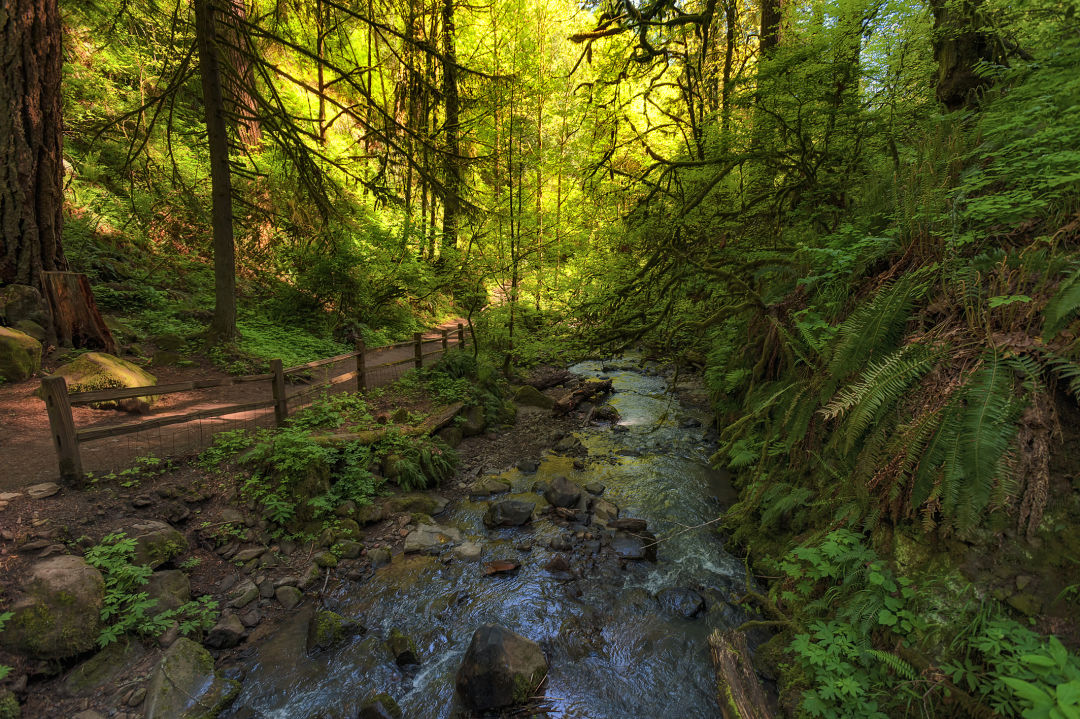
Lower Macleay Trail along Balch Creek
WHETHER YOU’RE AN EXPERIENCED HIKER or just want to walk near some trees, Forest Park is the place to go. We took the guesswork out of it, by hiking every inch of the hikes worth taking, and mapping ’em on our high-res Forest Park Map.
Our picks for:
Best Views (Hard, 3.5 miles)
A Good Workout (Hard, 3 miles)
First Time Hiking (Easy, 1.7 miles)
Tree Hugging (Hard, 6 miles)
Solitude (Moderate, 4 miles)
Post-Work Running (Moderate, 3 miles)
Picnicking (Easy, 2 miles)
Bird-Watching (Easy, 2 miles)
1. Best Views: Ridge Trail
Savor an unforgettable glimpse of one of Portland’s most photogenic bridges at the bottom of the Ridge Trail. The narrow path drops nearly 1,000 vertical feet from Firelane 7, near Skyline Boulevard, amid a quiet, seldom-visited section of the park. Just past Leif Erikson, pause to rest on a rough-hewn bench carved from a log, then exit the woods above Highway 30. Here maple and ninebark limbs frame a close-up portrait of the sea-green arches of the St. Johns Bridge towering over the Willamette. —Brian Barker
SUGGESTED ROUTE: Turn into the parking area at the end of NW Springville Road off of Skyline Boulevard, then follow Firelane 7 and turn left down the Ridge Trail. Return the same way. (Hard, 3.5 miles out-and-back)
2. A Good Workout: Tolinda Trail to Waterline
The Tolinda Trail takes its name from the site of a former Camp Fire Girls camp in the park. But make no mistake: this is one tough cookie of a hike. In less than a mile, the route vaults nearly 400 feet up to Leif Erikson. Temper first-degree thigh burns by enjoying bright blazes of fireweed, numerous lilies, and a welcome shot of solitude. To earn a merit badge for pluck, proceed up the Waterline Trail, a steep, often muddy route that ascends along a ridge to a water tower set in a sunny meadow atop Skyline Boulevard. —BB
SUGGESTED ROUTE: From NW Germantown Road, take Tolinda Trail. Go left at Leif Erikson and then right, up Waterline Trail. Return the same way. (Hard, 3 miles out-and-back)
3. First Time Hiking: Lower MacLeay to Stone House
Set in a lush canyon alongside the cool waters of Balch Creek, the largest stream in Forest Park, Lower Macleay Trail is an explosion of licorice ferns, leafy salal bushes, moss-jacketed hemlocks, and some of the most impressive fir specimens in the park, including Portland’s most gasp-inducing heritage tree, a 242-foot, jade-crowned giant—the country’s tallest fir within a city. For more color, scope out the creek’s population of native cutthroat trout. Then explore the “Stone House,” the remains of a Works Progress Administration–era structure, built in 1936. Its lichen-coated walls make a killer fort for an afternoon. —BB
SUGGESTED ROUTE: From NW Upshur Street follow Lower Macleay Trail for almost one mile. (Easy, 1.7 miles out-and-back)
4. Tree Hugging: Maple Trail Loop
Little-known fact: nearly three-quarters of the forest of Forest Park is bigleaf maples and red alders—not Douglas firs. Nowhere is this deciduous umbrella more delightful than along the aptly named Maple Trail. In fall, groves of bigleaf maples here rain down piles of crimson-and-gold leaves. But the Maple Trail hikes well in the dog days of summer, too. The 2.6-mile section between lower Saltzman Road and the Wildwood Trail bisects densely wooded canyons peppered with hemlocks and firs, and fords the shimmery waters of Saltzman Creek. —BB
SUGGESTED ROUTE: From Saltzman Road off of Highway 30, turn left up Maple Trail. Pass Maple Tie Trail and turn right on Wildwood Trail. Descend Koenig Trail and return via Maple Trail. (Hard, 6-mile lollipop loop)
5. Solitude: Firelane 15-Wildwood Loop
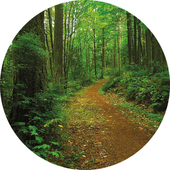
A trail through Forest Park
IMAGE: COURTESY JACQUELINE JAMES
In 2023, solitude is a relative term for Forest Park. But in this far northwest corner, you can still hike a full 30 minutes without seeing a soul. Start on Firelane 15’s high ridgeline entrance off Skyline, with hazy views of the Willamette peeking through a powerline corridor and the stunted peak of St. Helens beyond. Drop down to gurgling Miller Creek, up through thick, mossy old-growth, and pop back on the Wildwood’s narrow, serpentine trail. Don’t miss the path to secluded Kielhorn Meadow, a grassy knoll where you might peep an elk grazing if you’re quiet. —Benjamin Tepler
SUGGESTED ROUTE: From NW Skyline Boulevard, follow Firelane 15, cross over the Wildwood Trail, and turn up Firelane 12 to BPA Road. Go right on BPA Road. Turn right on Wildwood Trail. Return via Firelane 15. A signed path to Kielhorn is roughly 0.6 miles past the Skyline entrance. (Moderate, 4-mile lollipop loop)
6. Post-Work Running: Dogwood Loop
For a post-workday jaunt, it’s tough to beat this easy loop just off NW 53rd, a 15-minute drive from downtown. After the small parking area, keep left up the narrow Dogwood Trail, and then fork right to stay on Dogwood. The path levels out under a canopy of Doug fir and bigleaf maples—peek between the trees for views of the Willamette and the industrial riverfront below. In spring, keep your eyes open for yellow woodland violets and trilliums galore, while summer means candy flowers, fairy bells, and false Solomon’s seal. —Rebecca Jacobsen
SUGGESTED ROUTE: From NW 53rd Drive, take Dogwood Trail. Turn left on Leif Erikson and go left up Alder Trail. Turn left on Wildwood Trail. Return via Keil Trail. (Moderate, 3-mile loop)
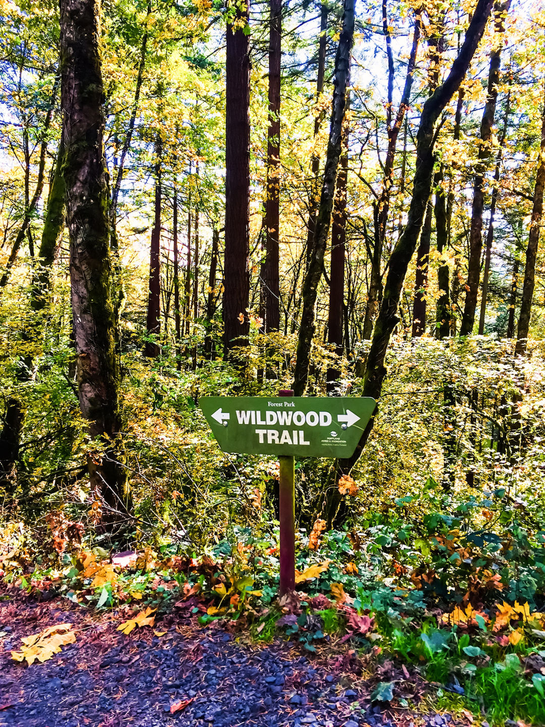
Wildwood Trail
IMAGE: LAKE11/SHUTTERSTOCK.COM
7. Picnicking: Nature-Wildwood Loop
Dreaming of a woodland picnic? Stuff your wicker basket and follow flat, wide Firelane 1 to two sets of mossy picnic tables. Walk off that charcuterie and Champagne by following the serene Nature Trail down to a leafy gully and across a footbridge over Rocking Chair Creek, eventually returning via the Wildwood Trail to Firelane 1. —RJ
SUGGESTED ROUTE: Turn off NW 53rd Drive onto Forest Lane, where you’ll find a few parking spots at the gate to Firelane 1. Take Firelane 1 to the picnic tables. Go past the junction with the Wildwood Trail, staying straight to take the Nature Trail. Take a left fork back to the Wildwood and a right on Firelane 1 to return. (Easy, 2-mile lollipop loop)
8. Bird-Watching: Audubon Society Loop
Keep a field guide handy inside the Audubon Society’s 150-acre reserve set just off of NW Cornell Road. More than 40 species of birds, including warblers, grosbeaks, and sparrows, have been recorded here. Bird-happy crowds typically head north from the parking area to the Pittock Bird Sanctuary. Here, an easy mile-long loop trail meanders along Balch Creek and encircles a pond scattered with lily pads. But the Founders Trail in the 34-acre Uhtoff Sanctuary is especially noteworthy. Nicknamed “Pileated Woodpecker Alley,” it’s packed with abundant snags, a siren’s song to North America’s largest woodpecker. Still skunked on sightings? Tour the on-site Wildlife Care Center, home to Audubon’s fleet of educational birds, including falcons and owls. —BB
SUGGESTED ROUTE: Take Founders Trail to North Collins Trail loop and return the way you came. (Easy, 2-mile lollipop loop)
For this and related articles, please visit Portland Monthly
Leave a Reply
Want to join the discussion?Feel free to contribute!