Hike of the Month: Linear Trail at L. L. “Stub” Stewart State Park
Spend a day exploring this state park’s 25-mile network of hiking, mountain biking, and horse-friendly trails.
A 45-minute drive from Portland sits L. L. “Stub” Stewart State Park, an old tree farm with a 25-mile labyrinthine network of hiking, horseback riding, and mountain bike–only trails—plus two mountain-style disc golf courses among trees and sword fern, if that’s your thing.
The park, named for timber baron and Oregon state representative Loren LaSells “Stub” Stewart, spans nearly 1,800 acres of land near the town of Buxton, opened in 2007 and is one of the state’s newest full-service parks. It also has a campground, with 90 campsites open year-round, and happens to be a popular spot for stargazing. OMSI hosts star parties at the park each summer.
With plenty of trails to choose from—a 3.5-mile segment of the paved Banks-Vernonia State Trail also cuts through the park—it’s easy to craft your own hike. That said, there are several mapped routes courtesy of websites like AllTrails.com (which requires a subscription) and Oregonhikers.org. Those include the Bumping Knots Loop, the Northern Loop, and the Linear Trail, which I did … kind of.
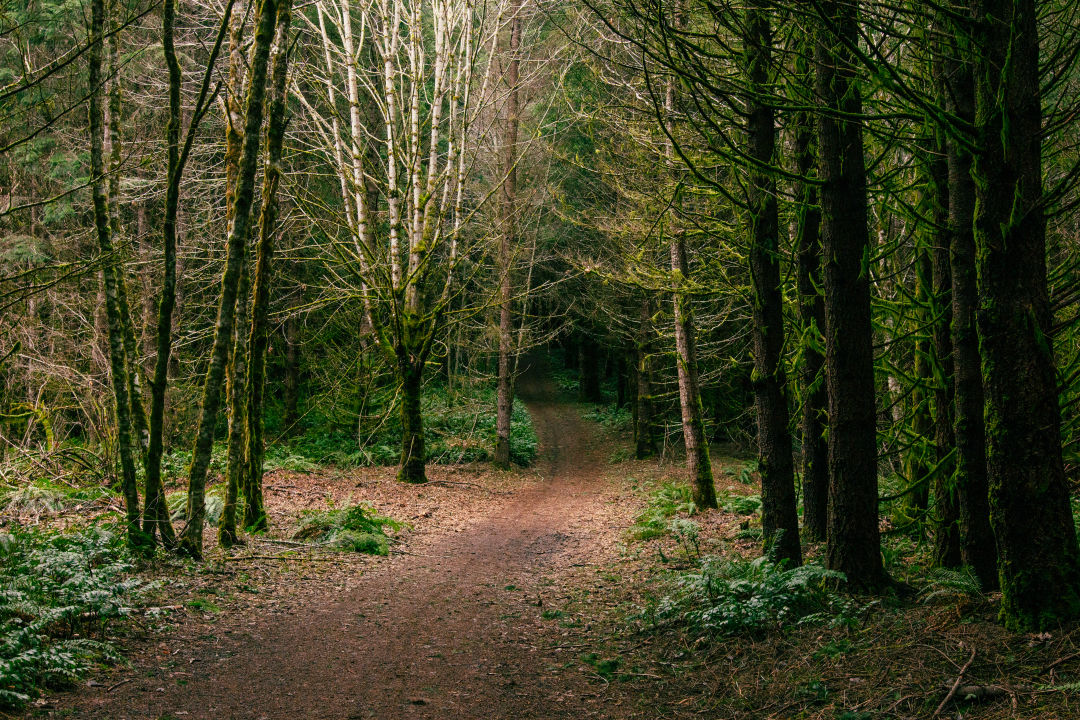
The Linear Trail winds through Sidewinder Horseshoe, Hares Canyon Trail, Unfit Settlement View, Skidder Row, and the Boomscooter Trail. Many of the trail names hark back to the park’s logging history. Boomscooter, for example, is the logging term for a small boat used to maneuver floating logs downstream to the sawmill.
I unintentionally did a modified version of the Linear Trail, making it a longer hike than I anticipated. Parts of the AllTrails route appeared to be missing and the park’s trail signage can be confusing, so I recommend keeping a trail map with you.
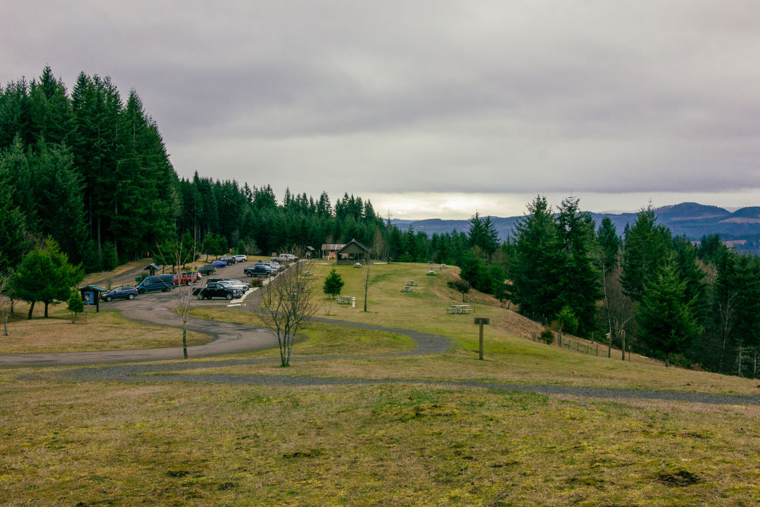
I started at the Hilltop Day Use Area, where you can park your car, let your dog frolic in the off-leash pet area, and enjoy a picnic while taking in the view of the Coast Range. Across from the parking lot is the Hooktender Horseshoe Trailhead, which enters a forested disc golf area. Keep right on Bullbucker Trail at the junction. After less than a quarter mile, you’ll reach Hares Canyon Trail.
I ambled down the Hares Canyon Trail, winding through second-growth forest for a couple of miles before turning onto Unfit Settlement View. (Note: there were a few fallen trees and some elevation gain on this path.) A little way up the trail, at an elevation of 1,528 feet, you’ll find a viewpoint—though much of the view was blocked off by trees. It did, however, offer a quiet spot to rest before hiking down to reconnect with Hares Canyon Trail.
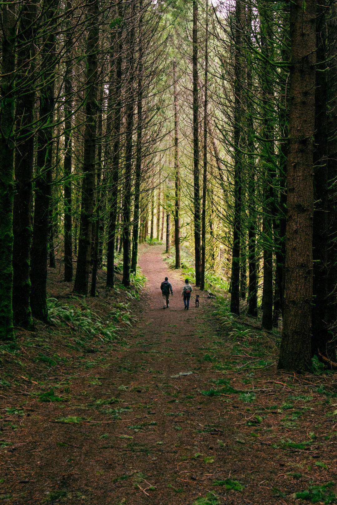
At the fork in the trail, you would turn right if you were to stick to the Linear Trail route, which runs past the Clayhill Horse Staging Area and Mountain Dale Cabin Village. However, I turned left, passing by the Hares Canyon Horse Camp. (You might even spot a few horses on your hike. If not, there are plenty of hoof prints, and road apples—a.k.a., horse poop—here and there, to let you know that you are sharing the trail with equestrians.) I continued along Peavey Hook Bridleway and turned onto North Caddywhomper Way, returning to the day-use area.
By the end of the loop, I hiked a total of 5.2 miles despite the Linear Trail being officially labeled an easy, 3.5-miles. Cold fog hung over the park the day I visited, so dress warm and be prepared for your boots to get a bit mucky; the trails were well-maintained but standing water and mud persists in some spots.
Drive time: About 45 minutes from downtown Portland // Distance: 3.5 miles // Difficulty: Easy // Type: Loop // Fee: $5 day-use pass
For this and similar articles, please visit Portland Monthly
Leave a Reply
Want to join the discussion?Feel free to contribute!